Saint-Jean-Sart orientation table

17 November 2026
The Saint-Jean-Sart orientation table, located at Knuppelstock on the heights of Saint-Jean-Sart (municipality of Aubel), is an installation dedicated to landscape interpretation. Erected in 2007, it is based on a relief topographic map engraved in stone, associated with 19 bronze symbols identifying landmarks visible from the site, such as Aubel, Julémont, Thimister, Gorhez Castle, and the Tihange power station.
The project originated in 2002 at the initiative of the Saint-Jean-Sart Quality-Village Committee. Following the acquisition in 2003 of a former military shelter to house the facility, the project was funded by public and local associations. The total cost of the project was approximately €36,009.
This support allows sighted walkers to orient themselves on the plateau, but it has also been designed for visually impaired people, who can “read” the landscape by touch thanks to the 3-D relief modeling.
At a bend in a hiking loop, the table stands out as a prime resting spot. A bench facing the horizon invites you to stop and appreciate the bocage landscape, between orchards, valleys and gentle hills, in a simple and open atmosphere.
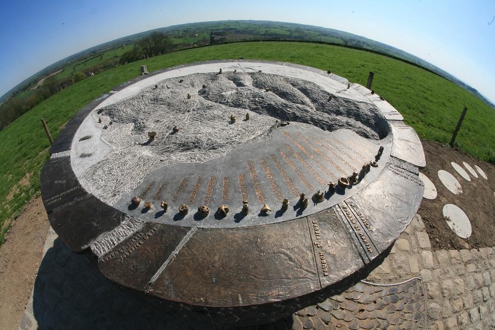
Orientation table of Saint-Jean-Sart (© paysdeherve.be)

Book with confidence

Quality assured

Authentic photos

Local & Here to help

Clear & Detailed

Family-run & Personal